You are hereUS / Mississippi / Mississippi Lakes / Lake Information for Enid Reservoir
Lake Information for Enid Reservoir
Enid Reservior (also called Enid Lake) is 28,000 acre surface lake with 220 miles of shoreline. There are several recreation areas around the lake including George Payne Cossar State Park, Bynum Creek, Chickasaw Hill, Hubbard Creek, Long Branch, Outlet Channel, Outlet Channel River, Persimmon Hill, Plum Point, and Point Pleasant that offer developed and primitive camping, fishing, boating, swimming, water skiing, picnicking, hiking, nature photography, environmental interpretive programs and horseback riding trail, containing parking areas, camping facilities, picnic shelters, boat launches, drinking water, restrooms, showers, swimming beaches, amphitheaters, and handicapped a assessible fishing pier.
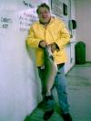
Enid Reservoir is famous for its crappie (world record 5.3 lb.), largemouth bass, catfish and bream fishing.
Exit 233 (Enid) off Interstate 55 North.
Businesses Located Nearby
Boat Rental
- Ricks Incorporated
- 2001 Mabyline St - Greenwood, MS
- (662) 453-5646
- Performance Marine
- 1775 Highway 6 E - Batesville, MS
- (662) 563-8278
- Surholt's Marine
- 414 Madison Ave - Clarksdale, MS
- (662) 624-9781
Vacation Rental
- Alluvian
- 318 Howard St - Greenwood, MS
- (662) 453-2114
- Big Easy Cottage
- 103 Glen Eagle Rd - Oxford, MS
- (662) 801-6762
- Downtown Oxford Inn & Suites
- 400 N Lamar Blvd - Oxford, MS
- (662) 234-3031


